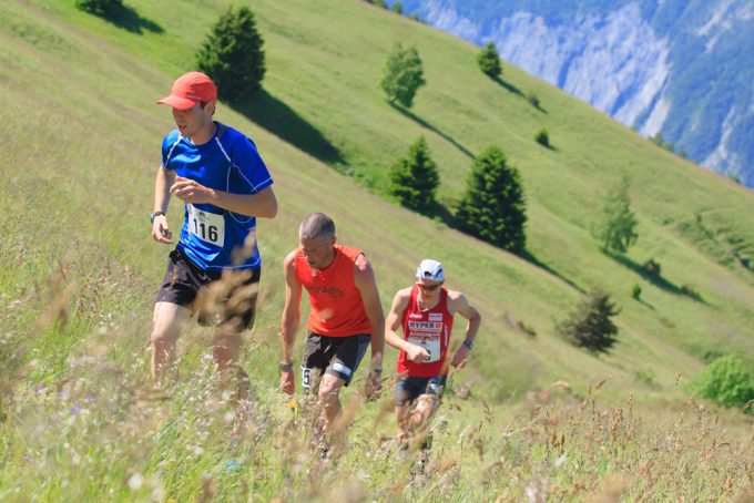
This lovely 42 km maratrail, with its height gain of 2100 m, takes you on a loop around three well-known mountains, the "Le Signal d'Auris", "La Buffe" and "La Croix de Cassini".
About : Le Tour des 3 Monts – n° 8 – Rouge
Oisans Trail Station Route no. 8 - Villard Reculas Trail centre
TECHNICAL INFORMATION
Departure/Arrival: Villard Reculas
Duration: 4 1/2 to 9 hours
Distance: 43 km
Max. altitude: 2200 m
Mix. altitude: 1200 m
Height gain: 2200 m
ROUTE
Turn left out of the Tourist Office towards Huez via the lane leading to the church, before taking the high road across the village. Turn left onto the path towards La Pierre Ronde and then back onto the road in Lachal. Stop to take a photo at the "Pas de la Confession" and admire the view over Bourg d'Oisans. After running through Huez, enter the Sarenne gorge and run on to the magnificent stone Roman bridge. Then comes the first big climb up to Maronne, followed by a change of path through the forest to Armentier. The next 5 kilometres are not for runners afraid of heights!! You will be running above the Route de la Roche, overhanging the Romanche valley to Auris en Oisans, with breathtaking views from the impressive slate side valleys. Once in Cours d'Auris, take the historic Chemin du Facteur, a path with views over the Chambon dam, les Deux Alpes and the Emparis plateau, into the untamed part of Oisans with no ski-lifts in sight. You can learn more about Protestants in Oisans during the gradual climb through Clavans le Bas and Clavans le Haut. Don't forget to fill up with water in the villages, as you will need it for tackling the climb up to the famous Col de Sarenne. Take a photo in front of the sign as cyclists always do. The route back down to the gorge starts on the road, before turning off onto a track, which is the longest ski run in Europe in the winter. Take the Chemin des Mules up to the Mine de l'Herpie and the Maison de l'Américain, before carrying on to Alpe d'Huez via the altiport. Watch out not only for cars when crossing Alpe d'Huez, but also for signs to the panoramic footpath that leads back to Villard Reculas via the Lac du Langaret.
THE ADDED BONUS: Sarenne
The Col de Sarenne stands at an altitude of 1999 m. It crosses the Massif des Grandes Rousses and separates Haut-Oisans from Alpe d'Huez. Made famous by the Tour de France, it is also a very popular starting point for hikes.
Route created with the website tracedetrail.fr
En bref
8 h 00
J+ : 2100 m
42 km
Level red – hard
Map and GPX marking
Le Tour des 3 Monts – n° 8 – Rouge
Villard-Reculas
Facilities
- Coach parking
- Parking nearby
- Car park
- Covered car park
- Public WC
- Defibrillator
Services
Activities
- Duration of the session: 480 minutes
Tours
- Average duration of the individual tour: 480 minutes
Download
Opening
From 01/06 to 31/10 daily.
Subject to favorable snow and weather conditions.
Location supplement
Starting point and arrival: Villard Reculas Tourist Office

